Friday 24th February,
If I was only allowed one word to describe today's walk, it would be "uncomfortable!" It started out so promisingly as well. Mo decided that, with a busy week of travelling planned for Saturday and the family coming for dinner on Sunday, she would stay home and rest up, thereby letting me loose for a longer, and possibly a little higher, walk. The weather forecast was for dry but breezy conditions and I was up early and driving just as the sun was coming up. It was only a couple of weeks back that I was down in Glen Esk when I went is search of the
Stables of Lee and at that time I had considered climbing Hunt Hill. The thing was that it was a beautiful day that day and I was more interested in getting photos of the reflections on the loch than of climbing hills, so decided to leave it until nearer the Summer when Mo might be up for it. Today however I decided that I'd climb it and confirm the route I wanted to take and if Mo wanted us to go back in the Summer I'd be a bit more familiar with the area. Well that was my excuse for getting some height under my boots anyway.
 Car park to myself
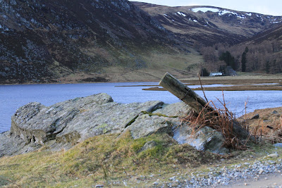
The breezy conditions forecast turned out to be a what felt like gale force winds whistling down the length of the loch and right into my face, so it was a long slow slog along the estate road towards the head of the loch. There would be no reflections today and I knew that the wind would only get stronger as I gained height. Never the less I was set on getting some uphill stuff done today so persevered in the hope that it might grow a bit calmer the further into the glen I got. It was to be a forlorn hope!
 Windy but clear
 Inchgrundle Farm
 |
| The ridge for today - walking up onto Bruntwood Crags on the right and along to Hunt Hill on the left |
The footbridge to the Falls of Unich is tucked underneath Bruntwood Crags and it was at this point I finally got a little bit of relief from the wind. It picked up again as I made my way up and around the crags following a faint and often broken path through the heather. It had been my intention to choose a spot between the crags and take a steep but hopefully short route up onto the ridge. However the path, although it seemed to be taking a fairly long route, was making its way up so I followed on until I ran out of patience and reverted to the original plan of scrambling the short distance up to the ridge. The wind at this point gave the impression that it was really pleased to see me!
 On the way up
 |
| From the ridge at Bruntwood Crags looking back along the route in towards the loch |
The plan now that I was on the ridge had been to walk along the edge of the cliffs and try for some photos looking down on the falls and the
Cairn Lick route I'd used way back in March last year but with the wind coming hard from my right I decided that maybe moving away from the edge a little was the wiser move. I did however get a couple of the photos.
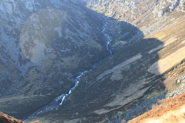 |
| Looking down on the Falls of Unich |
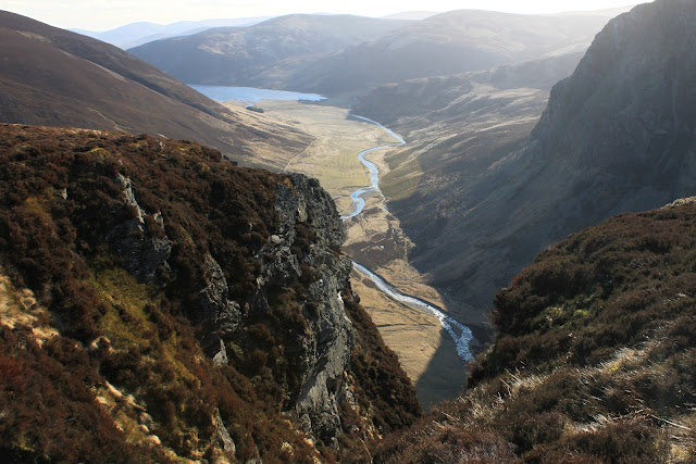 |
| From Bruntwood Crags along the Water of Lee towards the loch |
Eventually however I needed to turn back into the wind and head up the final slog to the summit of Hunt Hill. There was a wee bit of a detour around a peat bog that delayed getting to the start of the climb, (the delay was made longer by the wind blowing so hard it made my eyes water so badly that the inside of my glasses were wet and I was struggling to see anything, never mind a way through the bog!).
 The final slog up to Hunt Hill
Once out of the bog it was a case of head down and try to go up faster than I got blown back. It seemed to take a long time, but at last the rather innocuous summit cairn came into view and with it I think the wind took it as a personal insult that I had insisted on getting there!
 |
| First glimpse of the summit - apologies for the camera shake! |
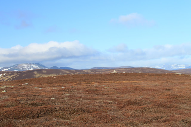
 |
| From Hunt Hill (705m) towards Lochnagar - camera's still shaking! |
Much as I had been looking forward to having a seat and some food at the top there wasn't any shelter so I made my way over the top and down towards the Falls of Damff. I did stop eventually under an overhanging rock formation that had the double advantage of being out of the wind but still in the sun. I could have sat there all day!
 |
| Off the top and looking back |
It had only been a brief and uncomfortable visit to the top but with a little food and some shelter I was already looking forward to coming back on a nice summer's day with no wind and needing sun tan lotion! The next part of the plan had been fairly fluid. One option had been to pick up the path coming up through the hanging valley above the Falls of Unich and make my way down under Bruntwood Crags; the second was to cross the footbridge above the Falls of Damff and make my way up over Cairn Lick and pick up the estate path back to Inchgrundle. I decided that I was reluctant to give up the height I'd battled so hard to gain so Cairn Lick was the route of choice.
 |
| Bridge to Cairn Lick |
 Towards the Falls of Damff
 |
| Looking back across the bridge to Hunt Hill |
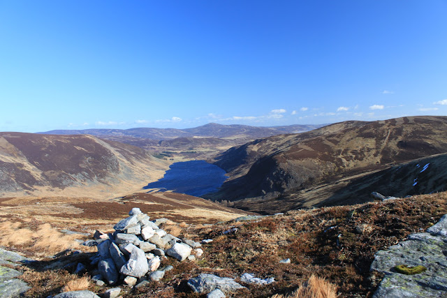
I'm familiar enough with the path up to Cairn Lick to know that it's always wet - even in the summer! Needless to say therefore that it was just the same in February, only more so. On the upside though the wind was firmly at my back so for the first time today I wasn't cursing it. All good things come to an end of course and as I turned to make my way along the top of the cliffs at Craig Maskeldie and up onto Cairn Lick it was again hard onto my right side. The rewards however are the great views of Loch Lee.
 |
| Loch Lee |
 |
| Cairn Lick (682m) |
I had hoped that when I picked up the estate track down the fantastically named Shank of Inchgrundle that the wind would finally be my friend. It was not to be as it swirled and gusted so much I almost, but didn't quite, start shouting at it! To take my mind off it I started wondering about the names of the places I'd passed today - including
Dog's Hillock,
Brides Bed and
Smith's Gutter as well as
Shank of Inchgrundle - and I decided that I was glad that the names already existed because can you imagine what "modern" names we might come up with? I just don't think we have the imagination anymore.
 |
| The hidden lochan of Carlochy |
 Loch Lee
 Pine Wood
I sheltered for a while in a heather made grouse butt, ate the last of my food and reflected on what had been a challenging day. I'm pretty certain that I'll be back up Hunt Hill, it was too fine a walk for the abiding memory to be the wind. I might just change the route next time though. There's a post on Walking Highlands by
Chris W with what sounded like an interesting route so maybe I'll try that one next time. The walk back along the loch was pleasant enough, especially with the wind at my back and for the first time since I'd set off I began to meet one or two early evening walkers.
 |
| Craig Maskeldie with Hunt Hill behind |
 The old Glen Esk Kirk
On the final walk back to the car park I stopped off to visit my second church in two weeks, (my Mother will be pleased, but maybe I'll not say anything in case the shock is too much). This one is the Church of Scotland Parish church that replaced the old one on the lochside. It wasn't in quite as good a condition as St Drostan's but it was quiet and out of the wind!
I might have stayed around for a wee while but there were a couple having a look round when I arrived and another couple turned up while I was taking photos, so I decided that I'd be just as comfortable in the car. I'd set off just before nine o'clock and was taking my boots off at the car just before four. It had been a fine day although maybe just a little bit harder than I had planned for this early in the year.
J
More photos
 Car park to myself
 Windy but clear
 Inchgrundle Farm
 On the way up


 The final slog up to Hunt Hill


 Towards the Falls of Damff


 Loch Lee
 Pine Wood
 The old Glen Esk Kirk


